User Manual
A free web portal for every Pixelmast boat: a live map of your fleet, full track history with replay, a server-side anchor watch, alarm zones, weather routing and simple race tools — all fed automatically by your Can2wifi/N2K Tactic Gateway, Bridge or other paired Pixelmast device. Руководство на русском → · עברית →
1 · What it does
Any Pixelmast device that can reach the internet (the N2K Tactic Gateway/Can2wifi, the Bridge) can upload your position and instrument readings to Cloud Tracks once paired with a boat. From there:
| Feature | What it gives you |
|---|---|
| Live map | Every paired boat's current position, heading and instruments, updating in real time, plus nearby AIS traffic. |
| Tracks & replay | Every voyage is recorded and can be replayed with a time slider — track, wind, AIS traffic and instrument values together. |
| Anchor watch | Server-side drag detection: arm from the boat, an app, or the map itself; get an alert if the boat moves further than expected. |
| Alarm zones | Draw no-go areas/lines or advisory areas on the map; get warned if a boat enters one. |
| Weather routing | Compute a route between two points using forecast wind, waves and current, for your boat's polar. |
| Races | Set up a course, share a join link with the fleet, and see everyone's positions live during the race. |
| Sharing | Give crew or family a viewer or co-owner role on a boat, or share one trip by a plain link — no account needed to view it. |
2 · Getting started
- Go to pixelmast.com/cloud/register, enter your email, a password and your name, and acknowledge the aid-to-navigation notice.
- A confirmation code is emailed to you — enter it (or tap the link in the mail) to finish creating the account.
- Once signed in, open Boats → + Add boat, give it a name, and a pairing token is generated for it.
- On the device (e.g. the N2K Tactic Gateway's Setup tab, Cloud Tracks card), turn uploads on and paste that token. See the device manual's pairing section for the device side.
Once the device reports its first position, the boat appears on the live map automatically.
3 · The live map
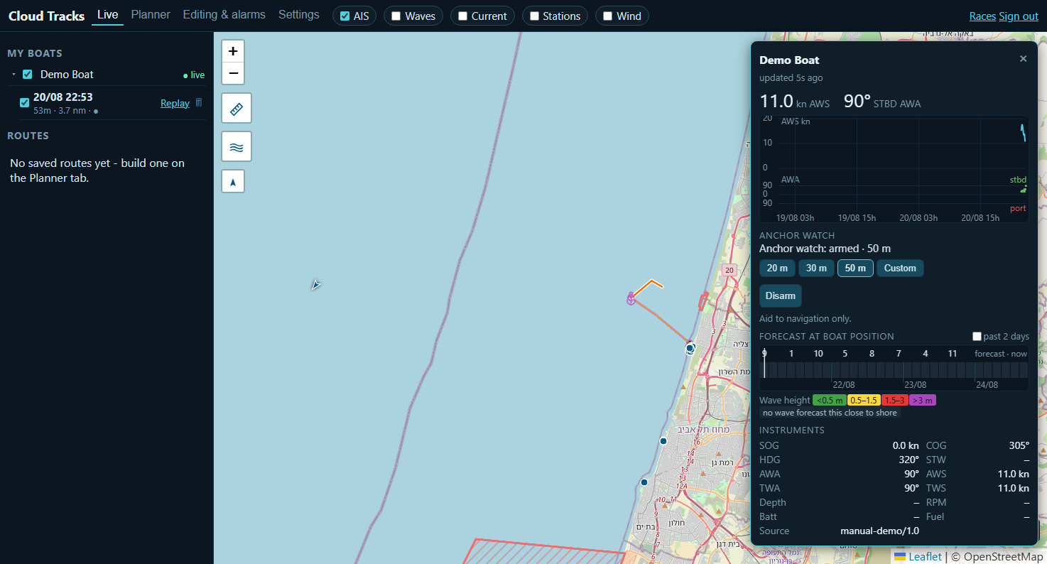
pixelmast.com/cloud/map — your boats (and any boats shared with you) listed on the left, split into My boats and Shared. Tick a boat to show it; click it to open its wind window. Layer toggles along the top add AIS traffic, wave height, current, weather-station observations and a wind-barb overlay on top of the chart.
4 · The wind window
Click a boat on the map to open its wind window: a small AWS/AWA graph, a full instrument readout (SOG, COG, HDG, STW, AWA/AWS, TWA/TWS, depth, RPM, battery, fuel, tanks — whatever that boat sends), a short-range wave/wind forecast at the boat's own position, and the anchor watch controls described next. It stays open and updates live as you sail around the map or switch boats.
5 · Anchor watch
The same watch described in the device manual — arming from the map, the boat itself, or a phone app all control one server-side watch; whichever command reaches the server last is the one that counts, so it's always safe to check or adjust from wherever you are.
- Open the boat's wind window (click it on the map).
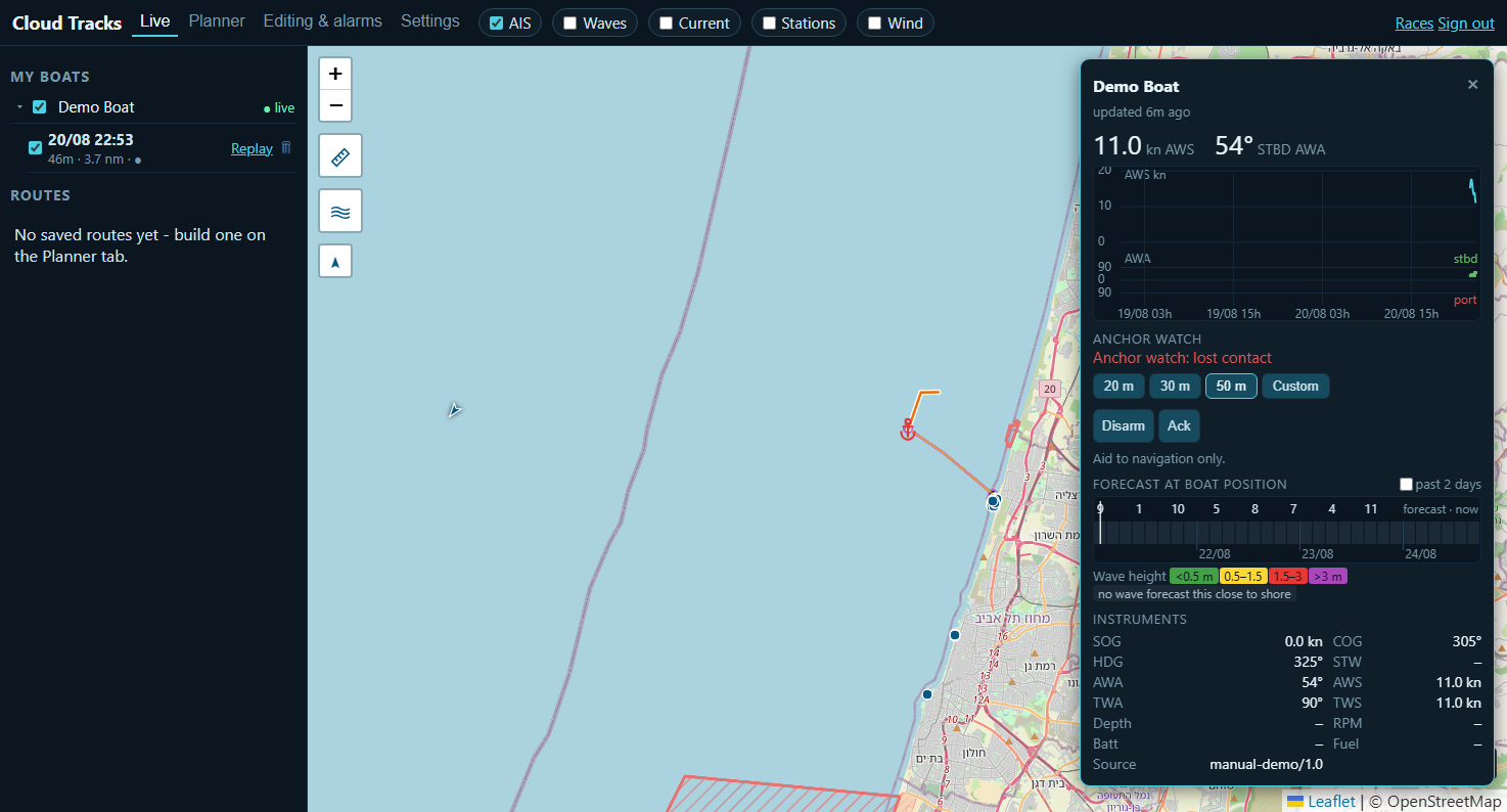
- Under Anchor watch, pick a distance: 20 m, 30 m, 50 m, or Custom (20–300 m, entered as a prompt).
- Press Arm.
Picking a different distance while already armed re-arms immediately with the new value. Disarm asks for confirmation — it stops the watch for everyone with access to that boat, not just you. If the watch raises an alarm, an Ack button appears to acknowledge it; acknowledging does not clear the underlying condition, only the notification.
| Alarm | Means |
|---|---|
| Drag | The boat's position has moved outside the watched circle. |
| Lost contact | The armed boat has stopped reporting — a dead link is treated as something to warn about, not silence. |
| No fix | Armed, but no trustworthy GPS position has arrived yet to watch. |
6 · Tracks & replay
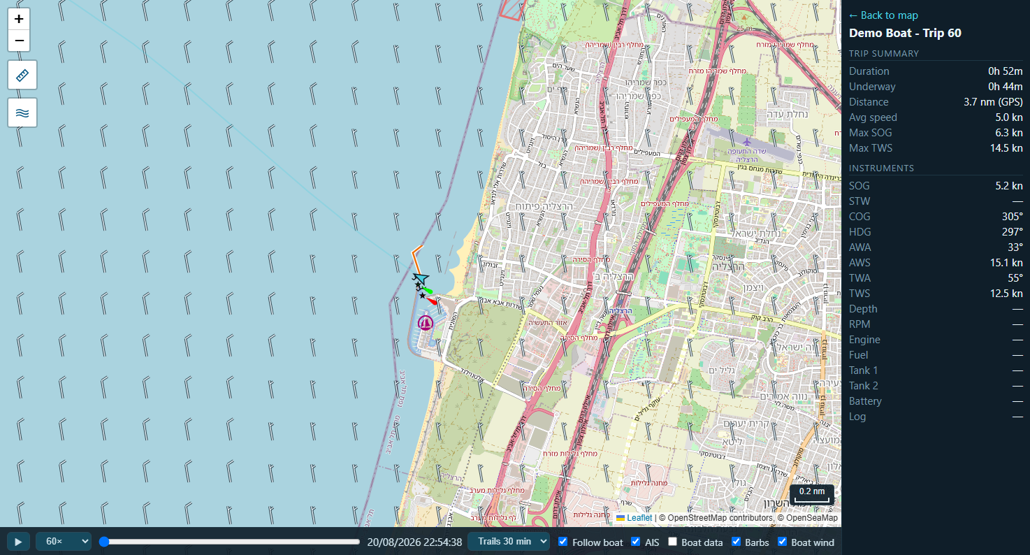
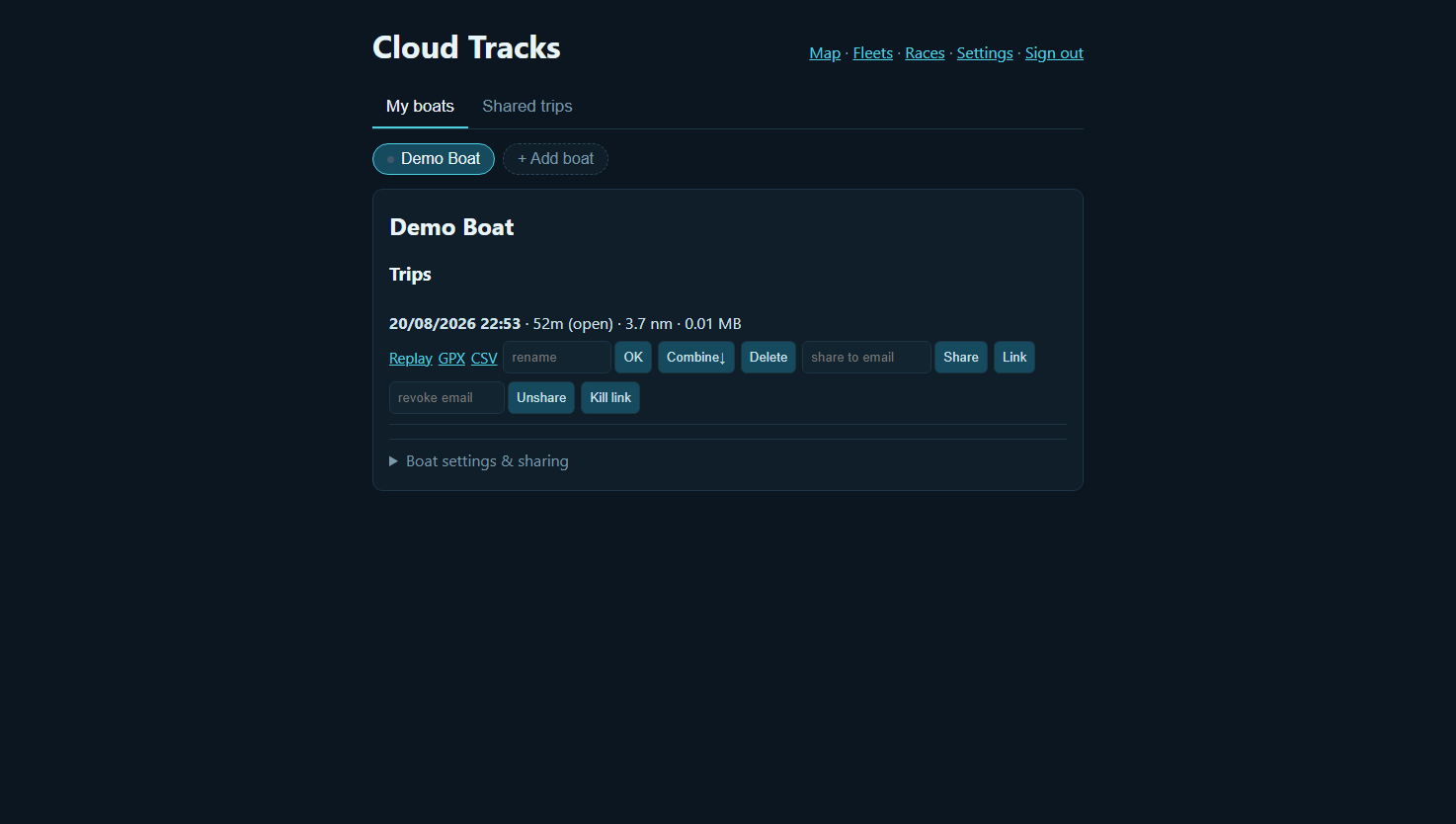
Boats lists every trip for each boat, with Replay, GPX and CSV export, Share (a link anyone can open without an account, revocable any time), Combine (merge an accidentally-split trip back into one) and Delete. Replay plays the trip back on the map with a speed control, showing the track, AIS traffic seen at the time, wind barbs, and the full instrument panel updating exactly as it was recorded.
7 · Boats & sharing
Boats is also where you manage each boat: rename it, see its pairing token, set performance limits used by routing (max wind/boat speed), upload a polar, and — under Boat settings & sharing — invite other people. Two roles:
| Role | Can |
|---|---|
| Co-owner | Rename, combine, delete and share the boat's trips, manage its settings and polars, add alarms, and manage who else has access. |
| Viewer | See the boat's live data and past tracks, and add their own alarms for it. Cannot change the boat or its data. |
Only the boat's owner can delete it. An invite is sent by email; the recipient registers (or signs in) and the boat appears under Shared for them.
8 · Alarm zones
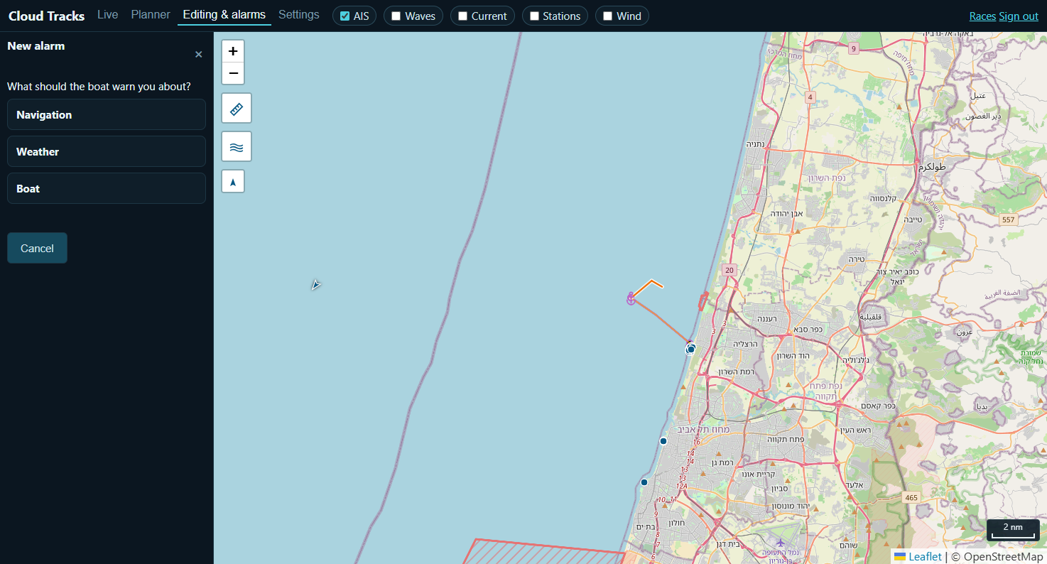
Editing & alarms → Map editing draws zones on the chart: a no-go area, a no-go line the router must avoid, or an advisory alert area. Editing & alarms → Alarms is where you attach an alarm to a boat — press + New alarm and answer one question at a time: what to warn about (Navigation — e.g. entering a zone; Weather — e.g. wind above a threshold; or Boat — e.g. engine temperature, a low tank, or shallow depth), then the specific condition and its threshold.
9 · Weather routing
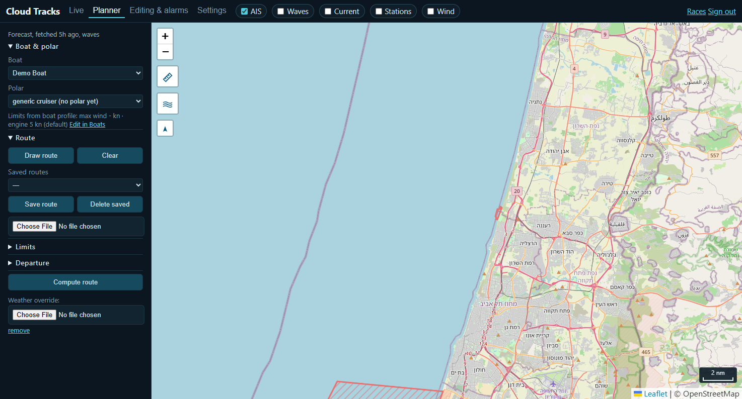
Planner computes a route between two points for a chosen boat and polar, using forecast wind (and, where available, waves and current) along the way — draw the route by hand or let it search, set departure time and any limits, then Compute route. Routes can be saved and reused, and a GPX can be imported as a starting point.
10 · Races
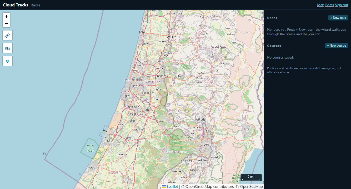
Races is separate from a single boat: + New race walks you through a course, then gives you a join link to send the fleet — everyone who opens it sees the whole fleet's live positions for the race. + New course saves a reusable course (marks and rounding order) without scheduling a race yet.
11 · Settings
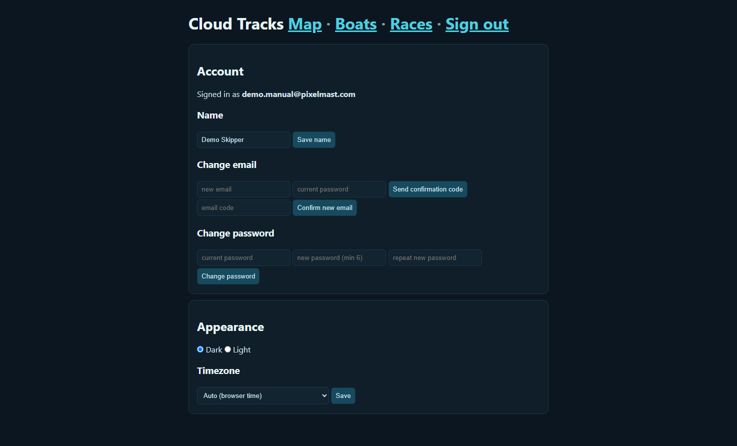
Settings covers your account: change your name, email or password, choose dark or light appearance, and set your timezone (or leave it on the browser's own).
12 · Troubleshooting
| Symptom | Check |
|---|---|
| Boat never appears on the map | Is the pairing token on the device correct and uploads turned on? Does the device have internet (not just WiFi)? |
| Position is stale / boat shows offline | The device needs internet, not just power and GPS — a WiFi-only boat with no internet uplink can't reach the server. |
| Anchor watch won't arm | Needs the boat to be paired and reporting (§2) — arming a boat that has never uploaded a position has nothing to watch yet. |
| No confirmation email arrives | Check spam; the code also works if you return to the same tab (it's tied to your session, not just the email). |
| Can't see a boat a friend shared | They must invite the email address you registered with, and you must accept before it appears under Shared. |
| Weather layers/forecast look empty | Forecast coverage is regional — it's fetched for a bounded area and refreshed on a schedule, not literally worldwide/instant. |
13 · Support
Questions, feature requests: admin@pixelmast.com